Hazardous Weather Outlook March 6-12th, 2022
Description: Provided by The National Weather Service Office of Pueblo...

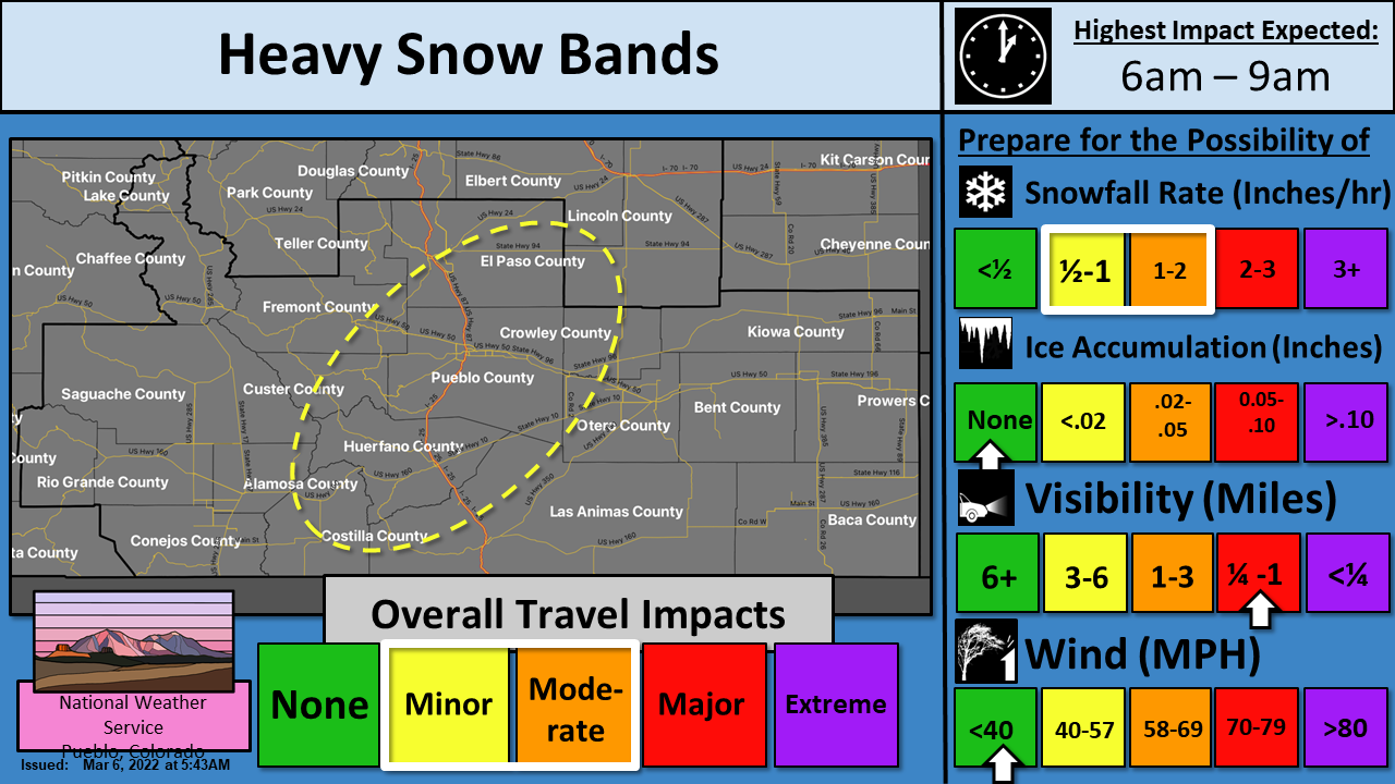
Hazardous Weather Outlook 3/6/22
This hazardous weather outlook is for portions of central...east central...south central and southeast Colorado.
DAY ONE...Today and Tonight Snow showers will spread eastward across southern Colorado this morning with snow falling heavy at times across the mountains and along the I-25 corridor and adjacent plains.
The heaviest snow will impact the eastern San Juan mountains and the Sangre De Cristo and Wet mountains where 4 to 10 inches will fall by late this evening.
The central mountains, Fremont and Teller counties, the Wet Mountain Valley and the I-25 corridor will pick up 2 to 6 inches with locally higher amounts possible under heavier snow bands this morning.
The southeast plains east of the I-25 corridor counties will see a trace to near 3 inches with the heaviest amounts falling along the northern slopes of the Raton Mesa across Las Animas county.
Narrow bands of heavy snow will be possible this morning along the I- 25 corridor which will lead to rapidly changing conditions over short distances this morning. Roads may quickly become slick and snow covered with poor visibility under the heavier snow. Snow will persist through the evening though will be more steady and light in and near the southeast and central mountains. Conditions will improve after midnight as snow diminishes.
DAYS TWO THROUGH SEVEN...Monday through Saturday An upper storm system will move across the region on Monday with snow possible, initially along the Continental Divide, spreading east into the Plains Monday night into Tuesday morning. The heaviest snowfall is expected over the southern Sangre de Cristo Mountains, into the Raton Mesa region, where 1 to 4 inches may be possible. A strong cold front will arrive late Wednesday afternoon another round of snow across the region, and much below average temperatures. Snow is expected Wednesday night into Thursday across much of southern Colorado. Afternoon highs on Thursday will likely struggle to reach into the 20s.
Follow SECO Weather on Facebook.
Follow SECO News on Facebook.
Subscribe to the SECO News YouTube Channel.
SECO Weather Sponsor


.png)


.png)
.png)


.png)


