National Weather Service Office of Pueblo: White Christmas Definition, History and Likelihood
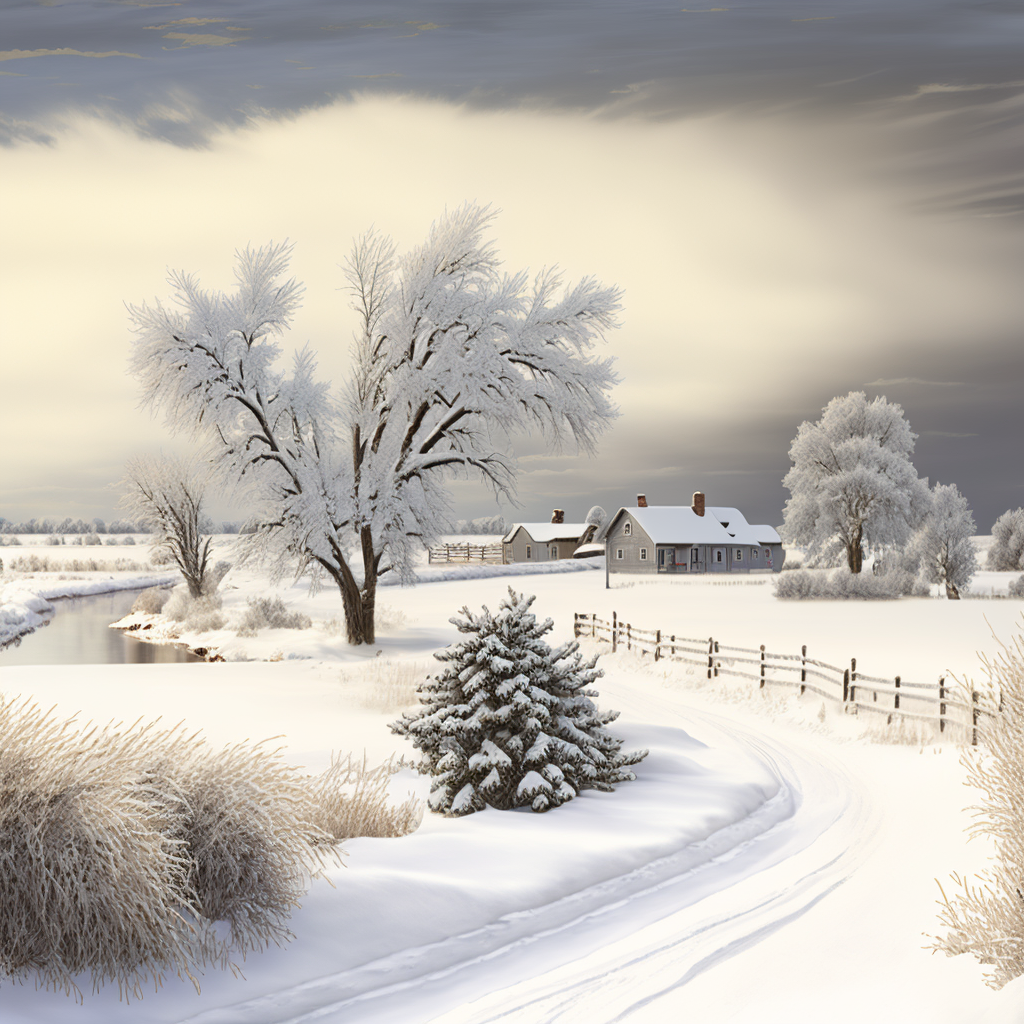
Description: Digital Image: Southeast Colorado White Christmas in the Country. This article is a excerpt from the National Weather Service Office of Pueblo article titled: "Southern Colorado Christmas Weather Facts," the link to the complete article is included below.

All content provided by the National Weather Service Office of Pueblo, Colorado.
National Weather Service Office of Pueblo: White Christmas Definition, History and Likelihood
Wishing for a "White Christmas?" There are varying definitions pertaining to what exactly is a “White Christmas.” Some use only snowfall data, while others use only snow depth data and yet others which use both data sets to define a “White Christmas.” In the following “Christmas Facts” data, compiled from the Colorado Springs, Pueblo and Alamosa climate records, we have defined a “White Christmas” as greater than 0.5 inches of snow falling on December 25th with at least 1 inch of snow on the ground.
For those using just snow depth data, the following link from the National Centers for Environmental Information (NCEI former NCDC) gives historical probabilities of at least 1 inch of snow on the ground on December 25th across the country: https://www.climate.gov/news-features/featured-images/are-you-dreaming-white-christmas
In any case, the chances are not very good if you are wishing for a “White Christmas” across much of Southeast Colorado.
Christmas 2022 is on Sunday with current forecasts indicating warm and dry weather across most of south central and southeast Colorado.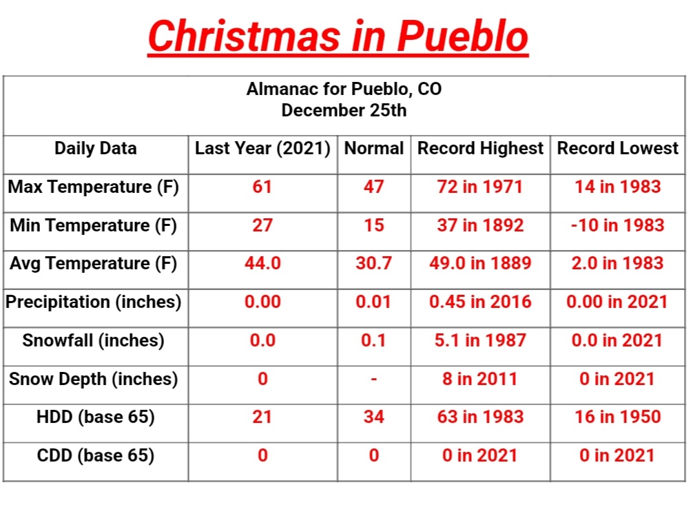
SNOWFALL
Record Snowfall: 5.1 inches in 1987
Number of times with a trace or more......19
Number of times with an inch or more.....7
Climatological chance of a trace or more...14%
Climatological chance of an inch or more...5%
Last measurable snowfall on Christmas Day: 2012 (0.2 inches)
SNOW ON THE GROUND
Record Snow on Ground: 8.0 inches in 2011.
Number of times with a trace or more.......21
Number of times with an inch or more......13
Climatological chance of a trace or more....29%
Climatological chance of an inch or more...18%
By our definition, the last “White Christmas” occurred in 2000. The snow began falling shortly before midnight Christmas Eve, with only trace amounts reported through the morning hours. The snow began to pick up during the afternoon hours and ended shortly before midnight, with a total snowfall of 1.8 inches. The next previous "White Christmas” occurred in 1987, when there was 1 inch of snow on the ground at 5 am that morning, and a record total of 5.1 inches falling for the day. The last time before that was in 1976. There was 1 inch of snow on the ground that Christmas morning, with an additional 0.6 inches falling that day. Since 1888, there has been only two separate occasions where snow has fallen on consecutive Christmas: in 1911 and 1912, and again in 1941 and 1942.
While not a white Christmas, an extremely rare event occurred early Christmas morning in 2016, when thunderstorms producing heavy rain and small hail moved through the Pueblo area during the pre-dawn hours. This is the only time such an event has been record since 1939, when thunderstorm and hail stats began.
Read More Including Historical Statistical Information for Colorado Springs, and Alamosa in the complete article from the National Weather Service Office of Pueblo, "Southern Colorado Christmas Weather Facts 2022."
Follow SECO Weather on Facebook.
Follow SECO News on Facebook.
Subscribe to the SECO News YouTube Channel.
Follow SECO News on Facebook.
Subscribe to the SECO News YouTube Channel.
SECO Weather Sponsor
.png)


.png)


.png)


.png)


.png)


.png)


