Aspen Acres Fire Grows to 50,187 Acres: New Aerial Photos Show Fire Activity, Retardant Lines and Black Hawk Water Drops

Description: The Aspen Acres Fire has grown to 50,187 acres in Pueblo and Custer counties. New aerial photos from Alaska CIMT #1 show active fire behavior, retardant lines, Black Hawk helicopter water drops from Lake Isabel, and reconnaissance operations on July 1, 2026. Read the Full Update from Incident Command...

Watch the Video Here:
The acreage of the Aspen Acres Fire has been updated to 50,187 acres.
Here are some photos from a reconnaissance flight taken by the Alaska CIMT #1 Incident Commander and Operations Section Chief yesterday afternoon.
Recon flights are used to collect information about the terrain, fuels, fire behavior, and other factors that assist operations personnel in developing a plan of action.
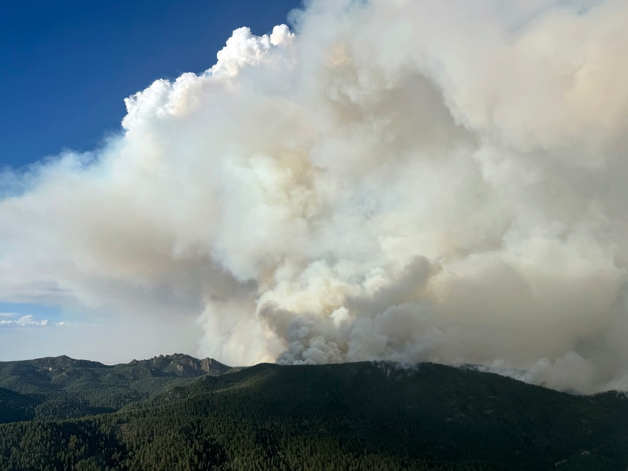
Photo 1 - The Aspen Acres Fire actively burns Wednesday, July 1, 2026, as seen in this aerial photo from above CO-165 Highway in the area of Squirrel Creek, looking towards Dome Rock.

Photo 2 - Retardant is visible in the trees of this aerial photo as the Aspen Acres Fire puts up smoke in the Willow Creek Area.
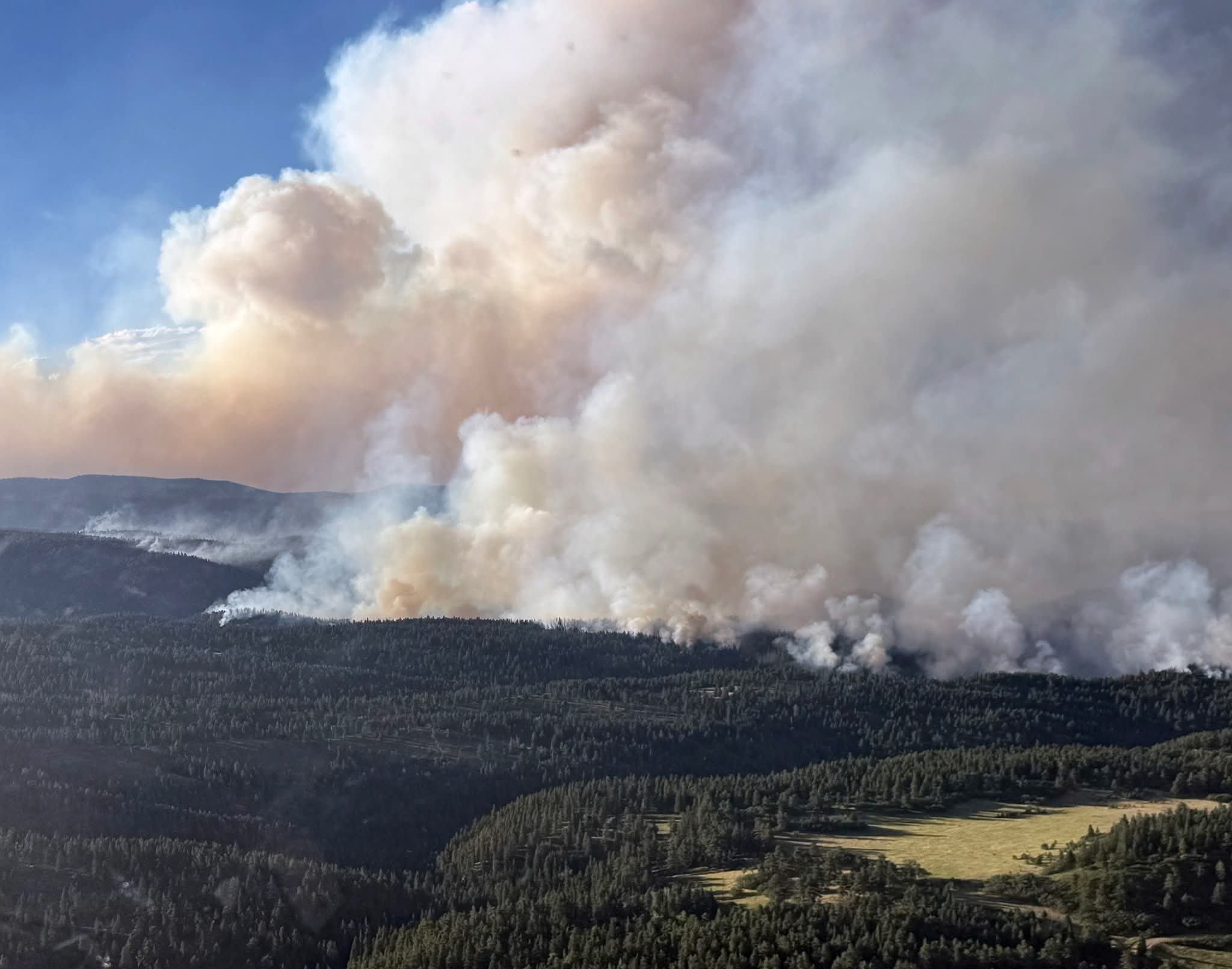
Photo 3 - A Blackhawk helicopter draws water from Lake Isabel for delivery to the Aspen Acres Fire.

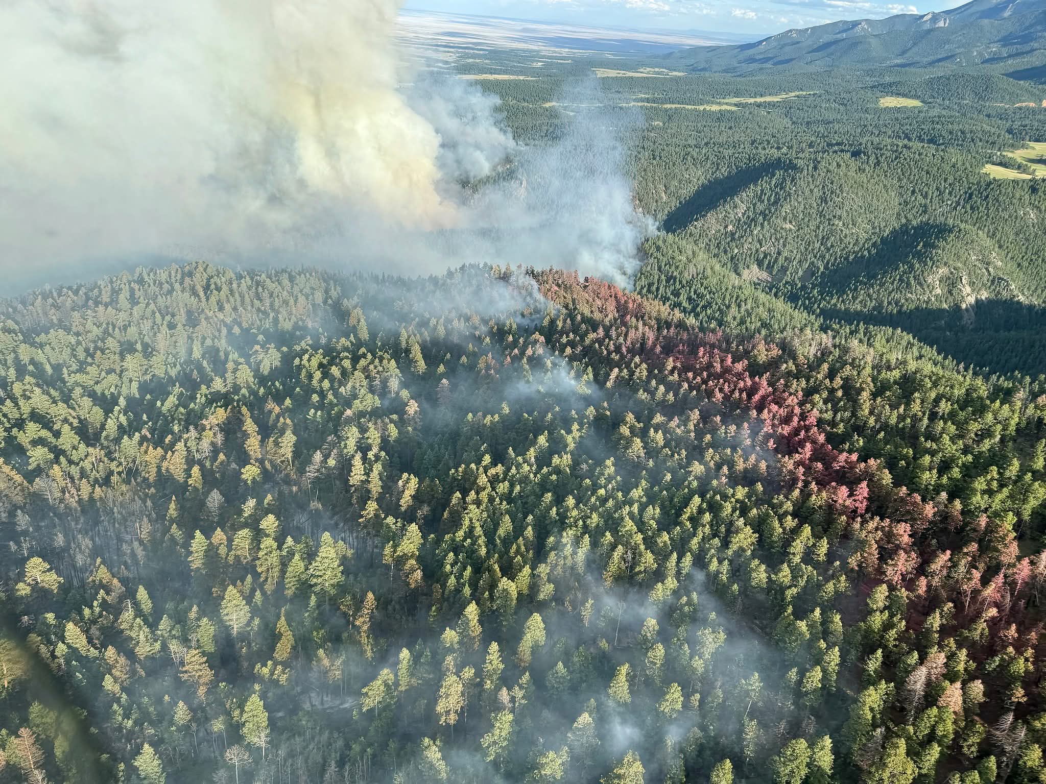
Photo 4 - Aerial photo from above CO-165 Highway, looking north towards Robb Road.

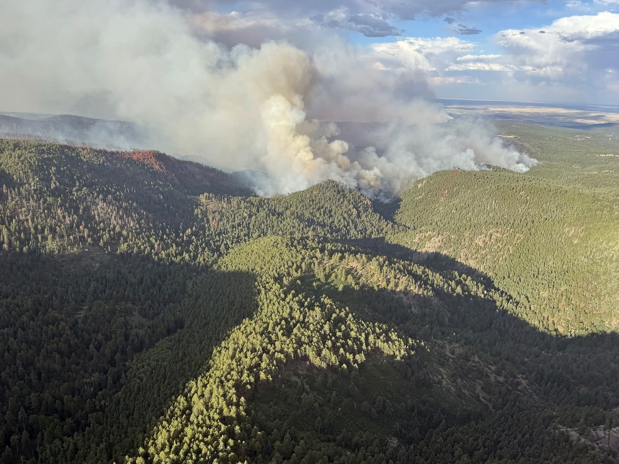
Photo 5 - Aerial photo from above Charles River, looking north.
All photos by Brad Washa, OSCC with AKIMT#1
Related Content
 Aspen Acres Fire Grows to 47,953 Acres With 0% Containment Near Rye, Colorado
 Aspen Acres Wildfire Update: July 2, 2026: 47,953 Acres; 0% Contained - Alaska Team Takes Command
 Huerfano County Pre-Evacuation Notice Remains in Effect for Aspen Acres Fire
 Aspen Acres Fire Evacuations Expand Near Red Creek Ranch as Red Flag Warning Continues
 Aspen Acres Fire Grows to 28,363 Acres, 155 Structures Lost as Red Flag Warning Continues
 Aspen Acres Campground Staff Clarifies Fire Origin Amid False Reports
 Aspen Acres Fire Property Assessments Underway as Officials Urge Public to Stay Out of Fire Area
Follow SECO News on Facebook.
Subscribe to the SECO News YouTube Channel.
Click to Zoom


Press releases Sponsor


.png)


.png)


.png)


.png)


